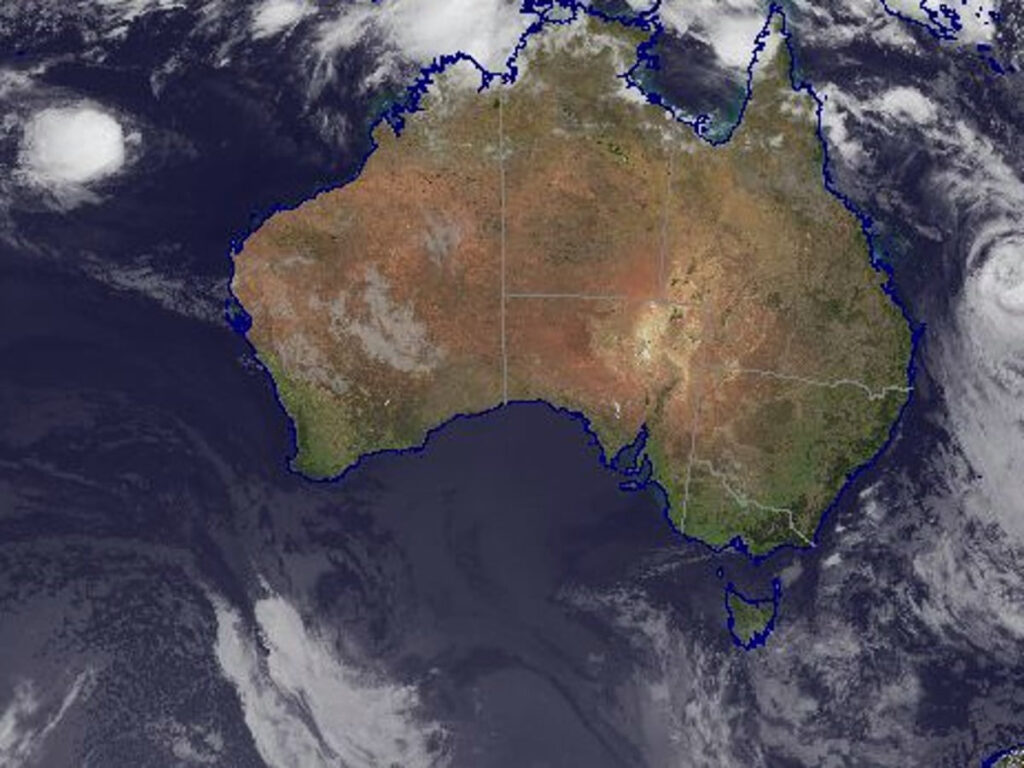
A tropical low in Queensland’s north-west could develop into a cyclone by Tuesday according to the Bureau of Meteorology, just days after Gabrielle passed over Norfolk Island.
The bureau is watching a low in Gulf Country, which has a 20 to 50 per cent chance of developing into a cyclone, senior meteorologist Harry Clark said.
“At this stage it looks like it will affect areas further west, so mainly over the Northern Territory side of the border in the Gulf Country, [it’s] certainly another tropical system to keep an eye on in what’s been a busy few weeks,” he said.
The system has Gulf communities on alert as they prepare for a deluge.
Bureau meteorologist Livio Regano said the north-west, already soaked from a strong start to the wet season, could expect further intense rainfall at the end of the week.
“Even as a low, we are expecting it to have a pretty big influence in terms of rainfall over the Gulf. Basically, anywhere north of Mount Isa can expect a good deal of rain over the coming days.
“Come Thursday, we’re looking at the first chance of showers and, from Friday onwards, it will get pretty wet,” he said.
Coordinator for the northern region’s District Disaster Management Group (DDMG), Elliott Dunn said residents in the gulf were preparing for higher flood levels.
“At the moment, the main concern is the additional rain.
“Most of the Gulf is already cut off with several towns completely isolated and if we do see more rainfall, further towns will be cut off.
“The DDMG will be liaising with local councils this week about whether more supplies need to be flown in ahead of more rain.”
Gabrielle to blame for excessive heat
Queenslanders can thank ex-Tropical Cyclone Gabrielle for the oppressive heat over the last few days.
Bureau of Meteorology Senior Forecaster Harry Clark told ABC Radio Brisbane while Gabrielle is now sitting near New Zealand’s north island, her presence was still being felt around Queensland.
“When it moved past it did switch our wind direction around to be a bit of a south-westerly which is fairly unusual for February,” he said.
“That dragged a lot of hot air from the interior towards the coast yesterday, so we saw those temperatures peaking in the high 30s for western areas and around 36 degrees in Brisbane City itself.”
It was the hottest February day in Brisbane since 2018.
Mr Clark said conditions across the south-east had eased slightly today with Brisbane expecting a top of 32 degrees and 34 for Ipswich.
“Today we have seen those winds swing back a bit more to the east across south-east Queensland at least, so today still quite warm … but certainly cooler than yesterday.”
Flash flooding forecast for south-east
Norfolk Island, 1,500 kilometres south-east of Brisbane, was battered by Cyclone Gabrielle over the weekend, but dodged the worst of the high winds as the system moved towards New Zealand.
Winds reached 85 kilometres an hour, felling trees and power lines and hurling boulders onto Cascade Pier overnight on Saturday — but still well short of the record gusts predicted earlier in the week.
Meanwhile the south-east of the state will have an “unsettled” start to the week, with the potential for thunderstorms and flash flooding south of Brisbane on Monday, Mr Clark said.
“On Tuesday, we do have potential for severe thunderstorms through south-eastern Queensland. With that we do once again see the risk of flash flooding,” he said.
“If we do get pockets of heavy rainfall associated with that, [we] couldn’t rule out some damaging winds and large hail with that as well.”
Source: ABC News


